Table of Contents
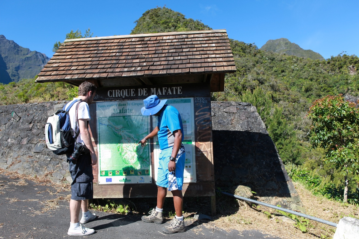
Criss-crossed by an extensive network of footpaths, the cirque of Mafate, accessible only on foot, is one of the island's hiking myths. Wild and enchanting, Mafate has to be earned. But what beauty! The noise of man does not affect it: you can forget!
An island within an island
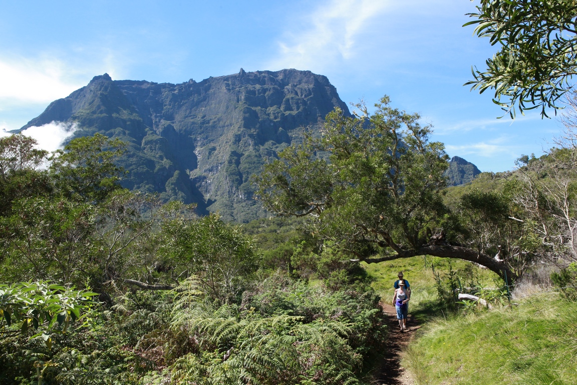
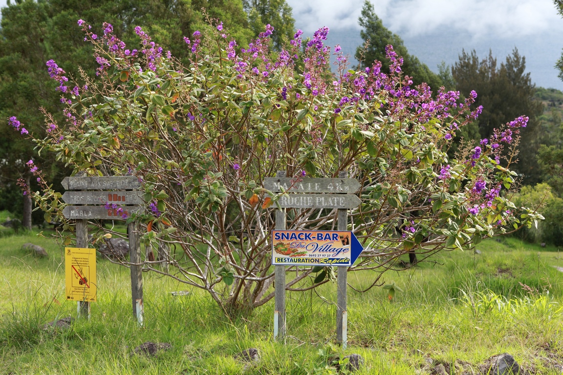
Along with Salazie and Cilaos, Mafate is one of the island's three large cirques, arranged at around 120° to each other around the summit of the Piton des Neiges, like the lobes of a cloverleaf. Difficult to access, Mafate is the wildest, most rugged and least inhabited. The only one that can only be discovered on foot, in the silence of the chaotic nature that characterises it. With 140 km of paths laid out by the ONF, Mafate is a haven of 80 km² of gullies, valleys, steep cliffs and waterfalls, watched over by the Grand Bénare massif to the south, the Gros Morne to the south-east, the Cimendef and La Roche Ecrite to the north-east and the Maïdo to the west.
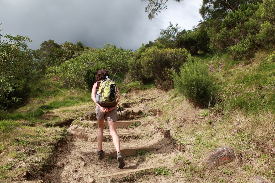
Depending on the access route, hiking in Mafate can be difficult. The most arduous entrance is undoubtedly the one at Le Maïdo, which is hard on the ankles (1000 m of very steep descent, 2 hours to get down and almost twice as long to get back up). " Santié par issi lé apik, kamarad "joked our guide Clovis. But we've got our " soulié la marche "But we prefer easier access.
From the Col des Bœufs to the Col de Fourche
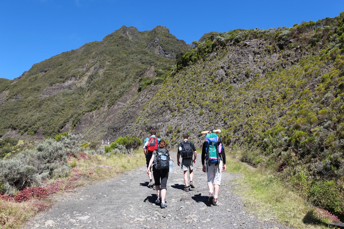
So we set off from Le Bélier, in the Salazie cirque, a quarter of an hour's walk from the Col des Bœufs, where you can leave your car (guarded car park). Then head for the Col de Fourche (1942m, GR R1). More difficult than the Col des Bœufs, but still bearable, this route has the advantage of allowing you to discover part of the Cirque de Salazie on foot before entering the Cirque de Mafate. The route takes two hours longer than the Col des Bœufs (1988 m) and allows you to admire the tropical forest scented with the flowers of longoses, a prolific rhizome in the ginger family. Here and there, you can spot Reunion auks, or locally known as "tec-tec" (Saxicola tectes), a protected species of shy forest bird endemic to the island.

Crossing a small stream, our guide points out the olivine crystals embedded in their basalt matrix. The spring water is pure throughout the cirque, so we fill our water bottles. A pleasant path leads down to the Grand Sable forest and then up, with some steep gradients, to the Col de Fourche.

A number of small red oratories dedicated to Saint Expédit (and sometimes to the Virgin) dot the route. The cult of Saint Expédit is very popular in Réunion, bringing together devotees of good and witchcraft. This Roman legionnaire, who converted to Christianity and died in the arena where Roman soldiers had thrown him to the wild beasts, was never canonised by the Church, Pius XI having struck his name from the martyrology. He is nonetheless venerated and sometimes invoked to cast a curse on an enemy...
From Col de Fourche to Plaine des Tamarins
At the Col de Fourche, there's a superb view of Salazie and the Piton d'Anchaing, which rises proudly above it! As we cross the pass, a new panorama opens up: the south of Mafate, its peaks and ramparts! Awe-inspiring!

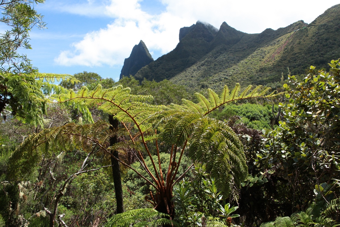
Alternatively, you can head straight for the Col des Bœufs (ascent +100m, ascent -505m, around 2 hours' walk to reach La Nouvelle or Marla, ideal for families with children). From this pass, in fine weather, you can see the small village of La Nouvelle below and the islet (pronounced îlette) of Marla, at the foot of Grand Bénare. Along the way, you can admire species endemic to Réunion such as the tree fern or the female Fanfan (Cyathea excelsa). Or mapou (Monimia rotundifolia), a tree with small, round, tough leaves.
An hour later, we reach the Plaine des Tamarins. An endemic mimosa of Réunion, the tamarin des Hauts (Acacia heterophylla or Bourbon oak) is a tree that can grow to a height of around twenty metres. It is found at high altitudes, and its wood is highly prized in cabinet-making. Very twisted, often bent over by the winds as they age, the tamarinds create a rather phantasmagorical backdrop on this plain when their silvery-white trunks pierce the mist. This enchanting spot is a popular place for hikers to take a relaxing break. Zigzagging through the tamarind grove, a path with cross logs and small wooden bridges prevents you from wading through the mud at the first sign of rain. But be careful not to twist your ankles! It's actually quite difficult to walk on it, so we prefer to go around it.

From the Plaine des Tamarins to La Nouvelle
We then follow the white and red markings. After 15 minutes, we reach a place called "La Découverte" on the edge of the plateau. From here, a few quick but easy switchbacks lead us downhill for 30 minutes to the sign indicating the start of the islet, at an altitude of 1420 m. A well-equipped picnic area (at the entrance to the islet, on the left) invites you to take a well-earned break, but if you carry on a few metres further you can sit down at the terrace of the "bistro" in the "capital" of Mafate, after admiring the magnificent Tibuchina massif framed by signposts.
You can also extend your walk by 10 minutes by passing through the plateau des chênes: this diversions will give you a lovely view of La Nouvelle. Or, from the Plaine des Tamarins, extend the route by bending left to head back down towards Maison Laclos. There are two paths leading down to La Nouvelle from Maison Laclos: take the first, which takes you past the Stèle J. Ethève and over the footbridge overlooking the Rivière des Galets, with its pools and small waterfalls. Further on, two paths overlooking the Gîte de Gravina head towards La Nouvelle: you can take either one as the gradient is identical. You finally arrive at La Nouvelle, the most densely populated islet in the Mafate cirque. Around thirty families live here all year round, mainly from tourism. Chickens peck around the houses and cows graze the fields in the valley. On site, you'll find a camping area, a grocery shop, gîtes and even a bakery. The huts have solar panels and water heaters, supplemented by generators when the cloud cover lasts too long.
Back to the Col des Bœufs
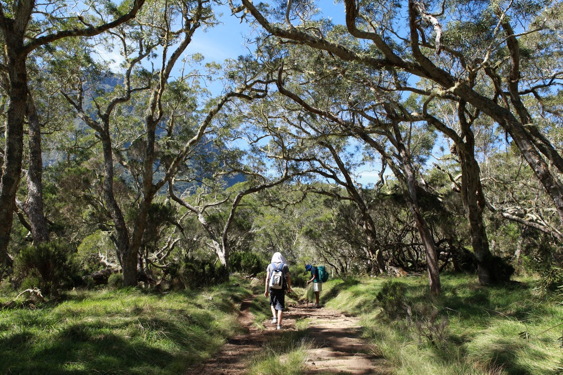
After a night on the islet of La Nouvelle, there are a number of destinations open to hikers the following day: return via the Col de Bœufs, Roche Plate or Marla via Trois Roches. We return via the Col des Bœufs (ascent + 505 m). We cross the Bois de couleurs des Hauts forest, where lush, abundant vegetation flourishes. Wrapped in frequent mists, its trees are generously covered with mosses, lichens and other epiphytic plants. From the lower canopy (8-10 m), where trees such as Mapou, Mahots and Bois de tambour grow, tree ferns (or fanjan) emerge and erect their fronds above the trees.
Then a series of fairly steep steps awaits us. We take advantage of the small terraces to admire the cirque and catch our breath. The route is very steep, with a few big steps. But they don't seem to put off the locals, who climb with their little ones on their shoulders to get supplies in town, although heavy supplies (and emergencies) are provided by helicopter. One more effort under the gaze of the papangue, a harrier endemic to the island, and we're back at our starting point.
Mafate
Mafate is originally the name of a brown slave. His name means "He who kills" in Malagasy. " Many Maroon slaves [...] formed defended villages [...] under the leadership of authoritarian chiefs. Some of these chiefs are said to have assumed the title of manjakes, synonymous with king in the Malagasy language. It even seems that they took on war names: Mafate (which causes death), Tsilaos (unconquerable)" (1). Mafate (or Maffack) became the leader of a community of brown slaves who found refuge in the most inaccessible cirque on the island. He left his name to a village (now extinct) and to the cirque of the same name. He is said to have been taken over by the great slave hunter François Mussard, who murdered him in 1751.
(1) - Histoire de l'esclavage à l'île Bourbon, J.V. Payet, published by L'Harmattan, 1991.
Advice
This hike takes place over two days. All levels of hiking are possible in Mafate. Bring mountain gear, water, a first-aid kit and protection from the rain, cold and sun, as the weather can change quickly. Note that there are no snakes or poisonous animals on the island.
Text: Brigitte Postel
Photos: Florian Ferry and Brigitte Postel