It's called the Volcano here. With all the deference that a vassal owes to his master. Shaken by regular eruptions, Piton de la Fournaise is the highlight of any hike on the island. An intense experience for lovers of volcanology and lunar landscapes.
Table of Contents
The whole island vibrates to the rhythm of the Piton de la Fournaise (2632 m), one of the most active volcanoes in the world, with over 200 eruptions in the last 350 years. Located in the south-east of the island, it erupts regularly. The first historically documented eruption dates back to 1640, and more than 200 have been recorded since then. The frequency of eruptions has particularly accelerated since the 1980s, with some eruptions occurring several times a year (notably in 2018, 2019, 2020, 2021, 2022 and 2023). The last eruption was brief, in January 2026.
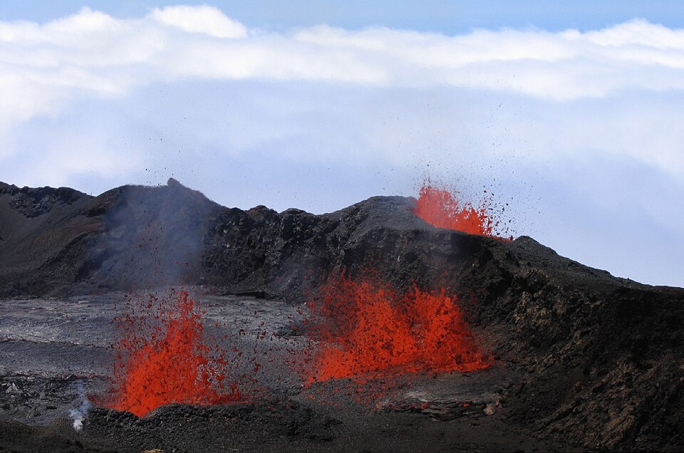
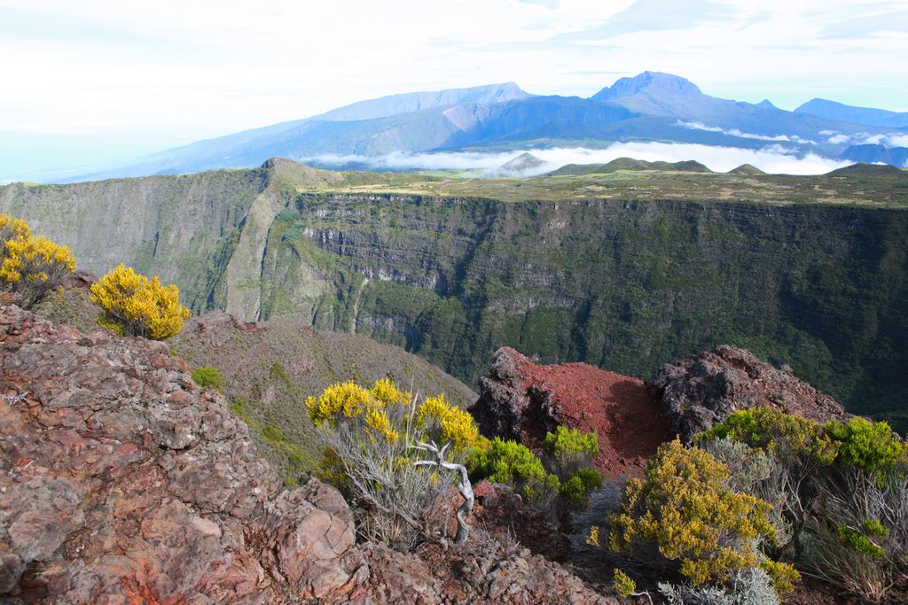
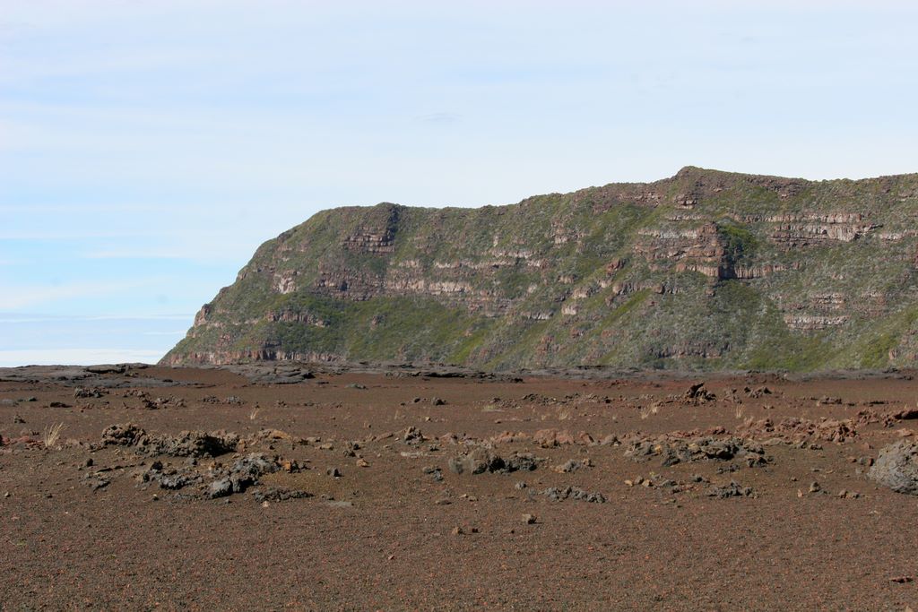
Rest assured, it's not dangerous: it's an effusive volcano, not explosive. There are no fiery, deadly clouds here, just rivers of basalt flowing into its natural spillway, the Enclos Fouqué, with its two interlocking summit craters, the smaller one, the Bory, formed in the XVIIIᵉ century, and the Dolomieu, the main active crater. It is from this crater that most of the flows regularly escape. As a general rule, the lava remains confined within the Enclos. But they do occasionally escape. The most significant event of the 20th century was the eruption of 1977, when the lava flows made their way out of the Dolomieu crater enclosure and into the ocean, causing extensive damage in the process. Part of the village of Piton-Sainte-Rose was destroyed. But miraculously, the church, now known as «Notre-Dame des Laves», was spared. Since 1979, thePiton de la Fournaise Volcanological Observatory, located in Bourg-Murat, monitors the «beast» day and night. Thanks to a network of seismometers, GPS and thermal cameras, the scientists are able to detect swarms of micro-earthquakes. Warnings are issued quickly, and access to the Enclos is regulated to guarantee public safety. The volcano's awakening drew crowds of curious onlookers. «Volcan l'a pété!» the people of Réunion say with a mixture of excitement and respect. At night, the black slopes light up incandescent red; By day, the solidified lava flows form a checkerboard of twisted basalt. Even outside these phases, La Fournaise remains Réunion's most visited site. To climb the flanks of this giant is to tread on a land in perpetual birth, a mineral landscape that continues to be written in fire.
The Volcano route
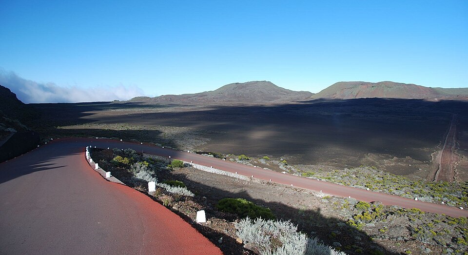
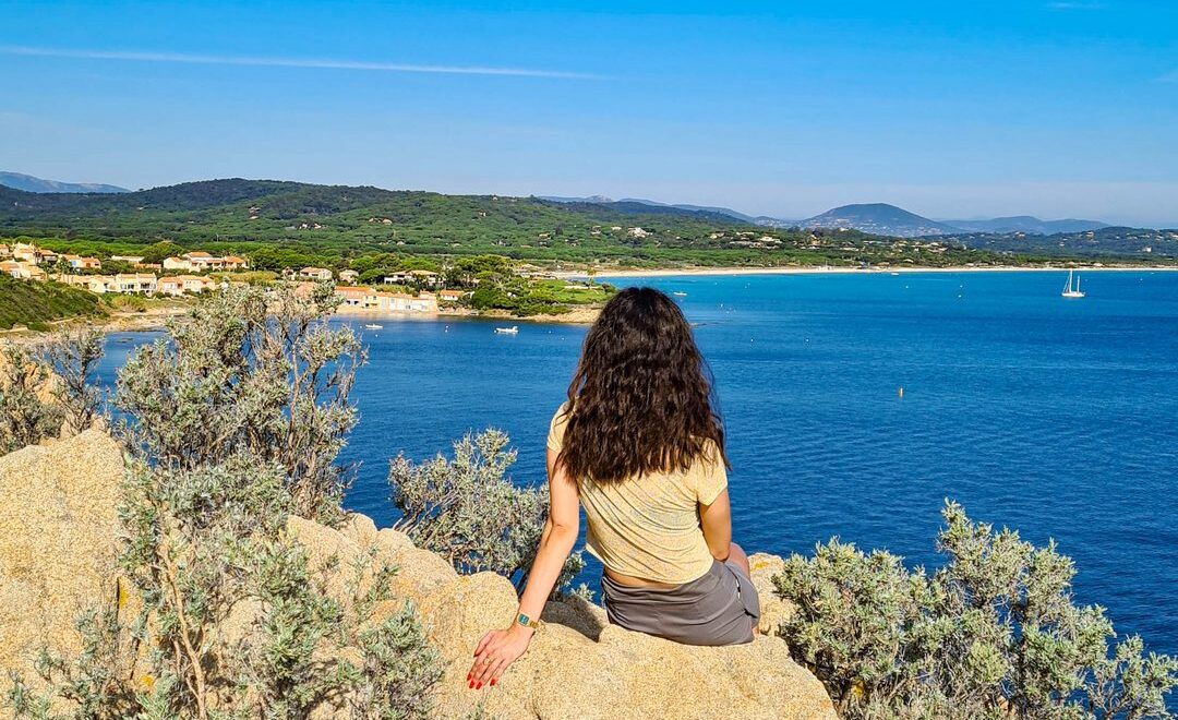
From Bourg-Murat, the Fournaise can be reached by car via the «Route du Volcan». The 24km route starts out in lush green countryside and continues through a landscape of rocks and brandes (also known as branles: an endemic heath shrub that unfortunately burns like straw and is traditionally used to make the so-called «volcano broom»). Some 30 minutes later, we make our first stop to admire the Piton des Neiges (3071 m, and very exceptionally snow-capped), a volcano that has been dormant for ten thousand years, but not extinct, contrary to what is generally said. Separated from each other by two plains, the Plaine des Palmistes and the Plaine des Cafres, the two giants, together with the cirques of Cilaos, Mafate and Salazie, attract the majority of hikers.
The Commerson crater
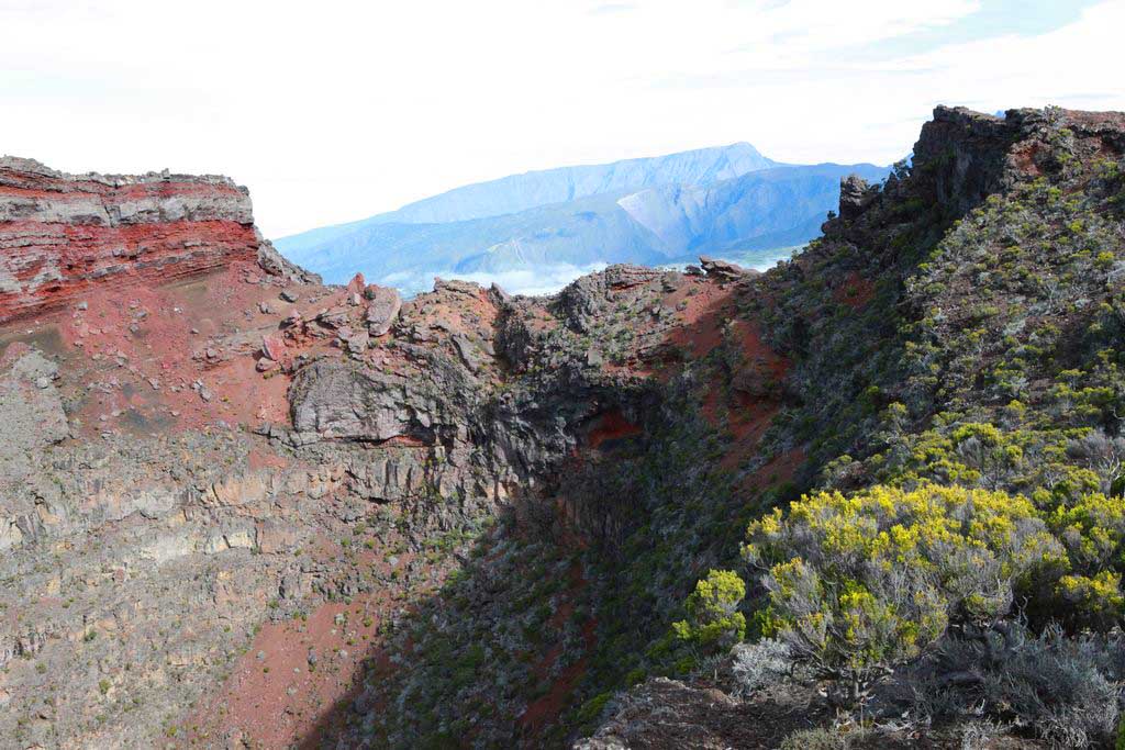
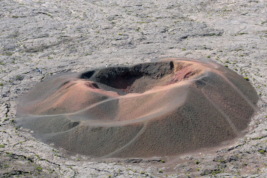
Twenty kilometres from Bourg-Murat, 100 metres from the road, there is a 120-metre-deep chasm, named the Commerson Crater, after Philibert Commerson (1727-1773), physician and naturalist to Louis XVI, who took part in theBougainville's expedition la Boudeuse and l'Étoile from 1766 to 1769. In 1766, on Bourbon Island (Reunion Island), he discovered the volcano, which earned him the honour of having the crater named after him. His companion, Jeanne Baret (1740-1807), a remarkable botanist, also took part in this expedition, as an «assistant and valet», disguised as a man because the maritime regulations of the XVIIIᵉ century forbade women on board. She was thus the first woman to circumnavigate the globe. Deception would be exposed in Polynesia two years later: upon encountering “Jean Baret,” the Polynesians addressed her as vahine (woman in Polynesian).
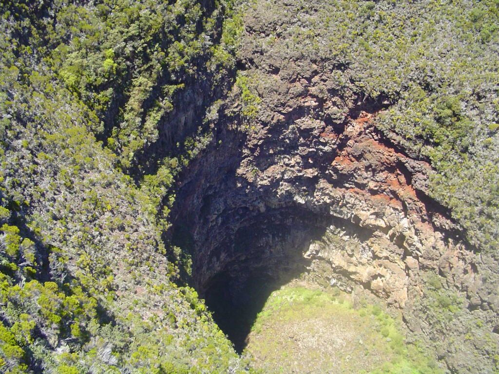
There is an easily accessible lookout point overlooking this impressive deep pit, whose mouth is known as the «Trou Fanfaron». This viewpoint offers a breathtaking view of the steep walls from which emerge the strata of successive basalt stacks. In order to vary the viewpoints of the Commerson Crater, you can walk around it without straying from the signposted path. The best time to explore the site is in the late morning, when the sun's rays at their zenith penetrate to the bottom of the deep crevasse.
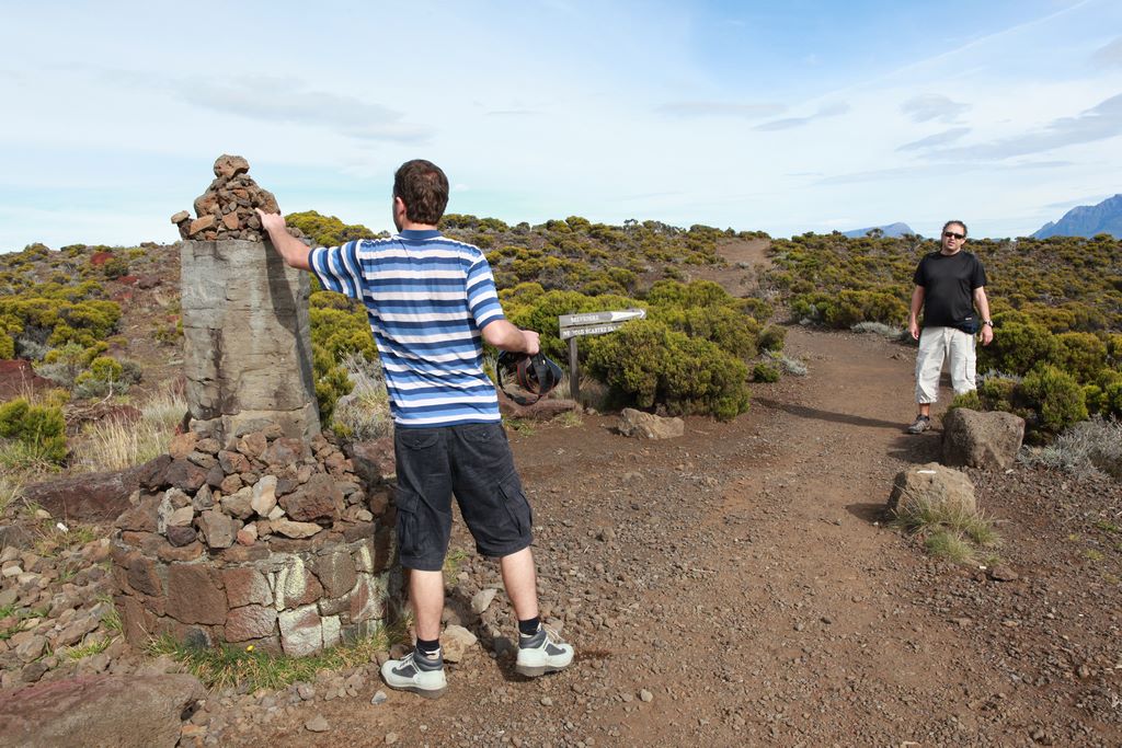
The alternative way of getting to the Volcano on foot is to follow the Josémont Lauret path, a historic trail used by Bory de Saint Vincent (1778-1846) (whose name was given to a caldera at the summit of La Fournaise), and where a guide, Josémont Lauret, died in 1887 from cold and fatigue. A stele commemorates him. In this exceptional altiplano landscape, you'll come across vegetation that burns under the sun and withstands the cold. White ambavils with paradoxically yellow flowers, and bushes of Phylica nitida, with narrow leaves and white flowers, offer their abundant blooms to walkers.
Plaine des Sables and Pas de Bellecombe
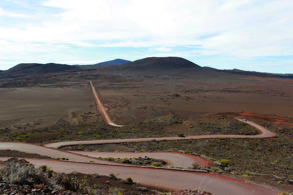
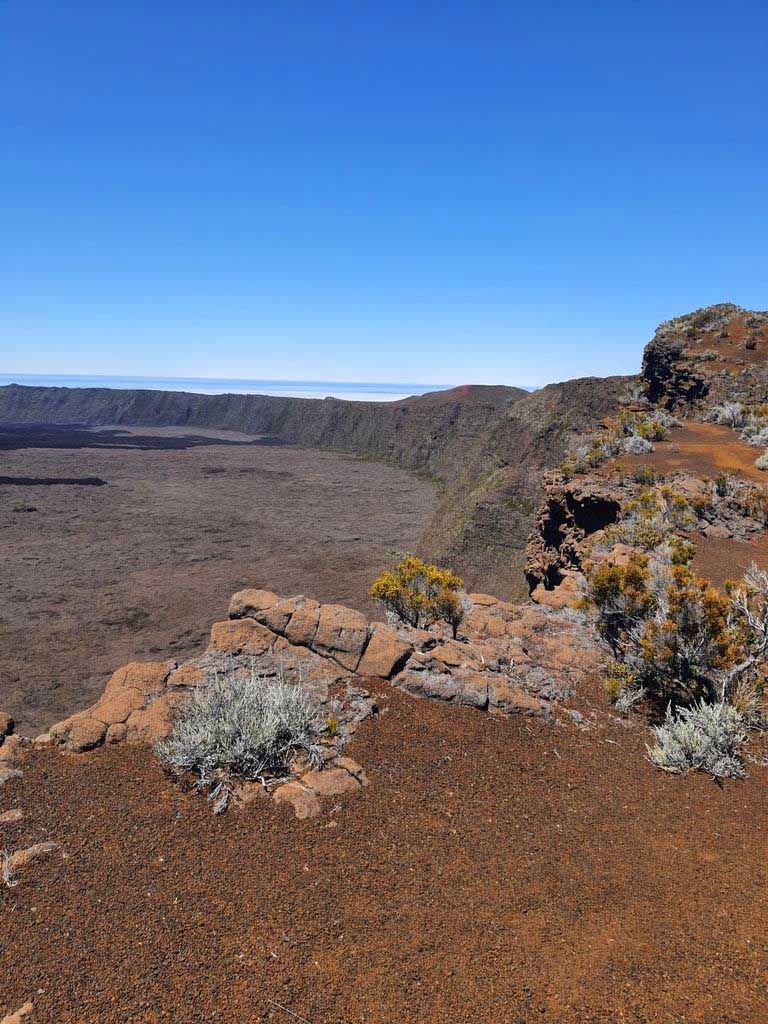
A few laps further upstream, we reach the Plaine des Sables. A grandiose mineral landscape, covered in orange-brown slag. This is without doubt the most spectacular and fascinating panorama on the island, covering the former caldera of the volcano. A rather bumpy ribbon road descends into the first enclosure and then runs across this vast desert expanse dotted with sparse clumps of sweet vernal grass.
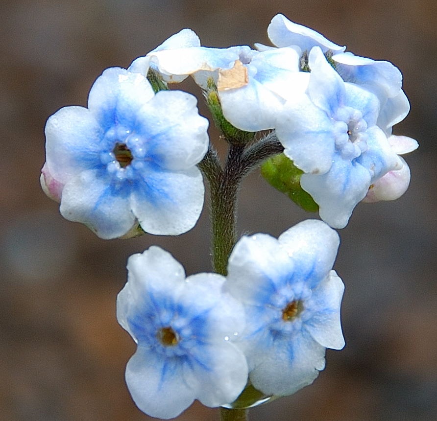
Depending on the season, you can admire the most precious flower of the area, whose blooms vary from pale blue to immaculate white, the rare Bourbon forget-me-not (Cynoglossum borbonicum). Rare and threatened, this flower is the subject of botanical monitoring in conservation programmes on Réunion. © DunogCommons.
A few more twists and turns and we reach the Pas de Bellecombe and its car park, where we have to leave our car. This is the only access route to the summit of the volcano, and is named after one of the island's governors, Guillaume Léonard de Bellecombe (1728-1792), who offered a reward to the first explorer who succeeds in discovering a passage leading to the Volcano. A Creole slave, Jacob, discovered the access in 1768. But the site has kept the governor's name, while its true discoverer has been forgotten.
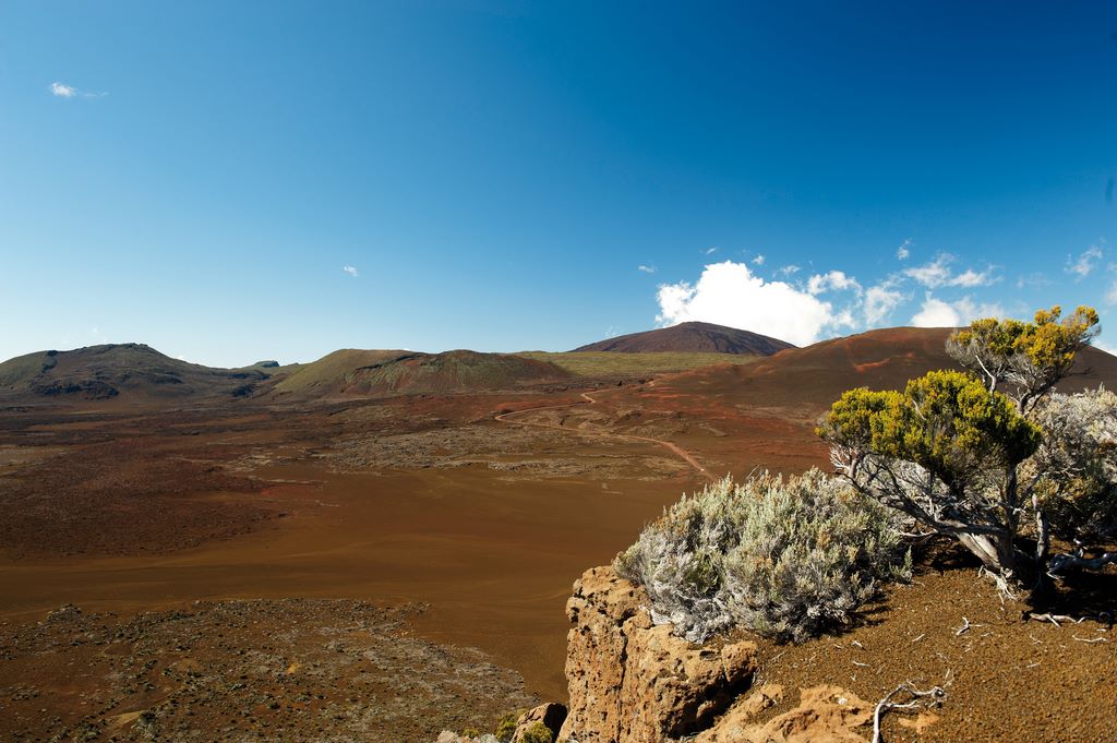
From the Pas de Bellecombe, we continue our journey on foot. The view of the volcano emerging from its basalt bed is exceptional. The heath shrubs then give way once and for all to a red, barren soil, marking the beginning of a magnificent desert zone. The only way to get down into the caldera, if you’re not a “galet-warmer” (a loafer), is to take the 526 steps to the Enclos Fouqué. On the cliff faces, the frail red bells of the Petit bois des remparts catch your eye. Don't pick it. This plant, also known as «mother-in-law's tea», is highly poisonous.
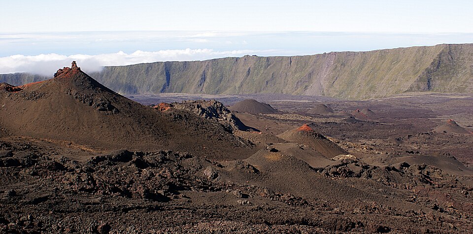
From Formica Leo to the Dolomieu crater
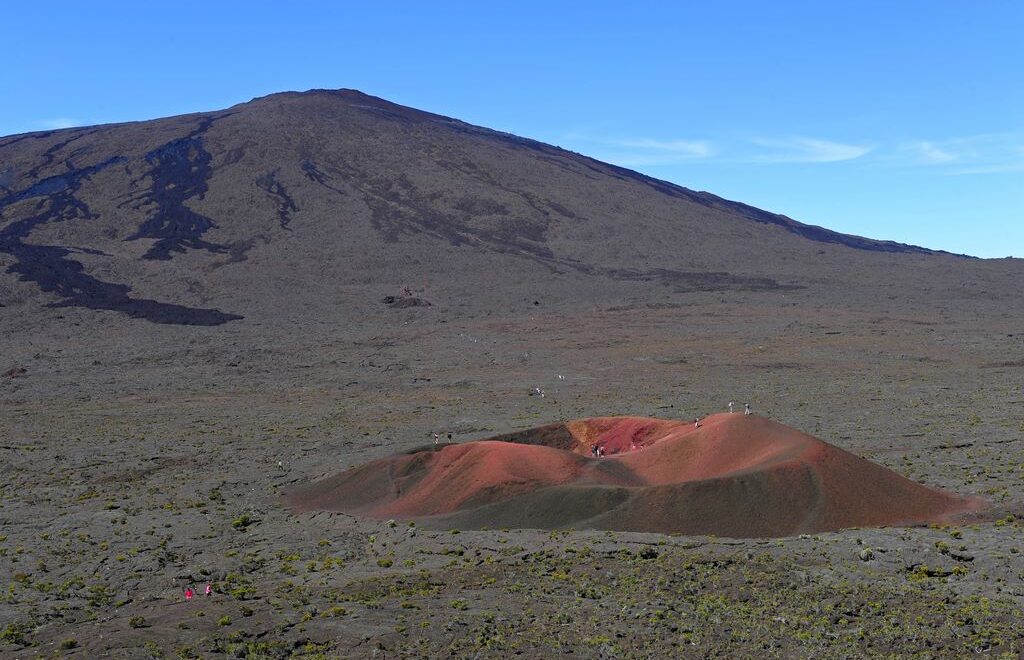
100 m below, in the Enclos Fouqué caldera, the Formica Leo, a young crater, the result of a strombolian eruption in 1753, forms an ochre-coloured knob in a setting of grey sand. Smooth lava has encased this lapilli piton in a a sheath of basalt, from which the fragile summit emerges. Made up of reddish slag that gives it its characteristic rusty hue (although this varies with the amount of sunlight), it bears a striking resemblance to the conical pits dug by the larva of the anteater, hence the name Formica Leo. A veritable photographic icon of the island, the small adventitious cone is undergoing considerable erosion, and it's possible that one day it will simply be off-limits!
There are currently three signposted trails through the Enclos du Volcan. The routes have been designed to avoid fragile areas of the ground, and to ensure the safety of walkers. Here, leaving the path is not a harmless act: under the black crust can hide lava tunnels or unstable areas.
The Fouqué enclosure via the Dolomieu trail
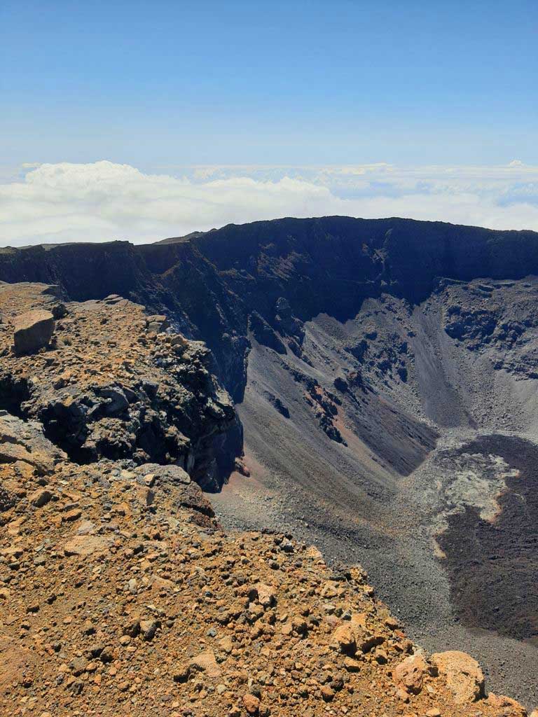
If you're feeling more sporty, take the time to climb up to the Dolomieu crater viewpoint along the path of the same name (return journey 11.9 km, average time 5 hours). Progress is made over hardened lava, sometimes smooth like twisted rope, sometimes chaotic and sharp. The walk is demanding: the wind blows without hindrance, the sun strikes without shadow, and every step echoes on the stone.
As you climb, the landscape is transformed into a mineral theatre. No trees, almost no visible life: just rock, slag and ancient flows frozen in their movement. It's quite a physical journey over hardened lava to discover a unique panorama of the charred soils of Enclos Fouqué, stretching as far as the eye can see, defying the blue horizon of the Indian Ocean that can be seen in the distance.
Alternatives: Kapor and Rivals
If access to the Dolomieu is closed or if you prefer a shorter hike, there are other routes that offer superb views.
The Kapor trail (return journey 7.5 km, approx. 3 hrs) takes in the crater that erupted in 1998. It bears witness to a historic eruption (the one in 1998, which lasted 6 months). Less long, but just as immersive, it allows you to get closer to a more recent scar of the volcano, where the rock is still dark and compact.
The Rivals trail (round trip 10 km, approx. 4hrs 30mins) is a modern alternative for exploring the Enclos. It leads to the crater of the same name, which erupted in 2006. On the way, you'll be rewarded with a magnificent view of the La Paix and Château Fort craters, which stand like crenellated towers atop the massif. They tell another side of the volcano: the side eruptions and the shapes sculpted by the wind and lava over time.
For the less sporty and families, there is another very easy path that runs partly along the outside of the Enclos. It allows you to zigzag along the side of the cliff, offering breathtaking panoramas without the sustained effort of crossing inside.
If you only have to do one hike in Réunion, don't hesitate and climb up to the craters. You won't regret it.
Walking on a live volcano
Hiking Piton de la Fournaise is not just about racking up the miles. It means entering a world that is almost exclusively mineral, where silence is only disturbed by the wind. It means feeling underfoot a land that, on a geological scale, is still in the process of being born.
From the small ochre cone of Formica Leo to the immense gash of Dolomieu, the walk tells a story of fire, collapse and rebirth.
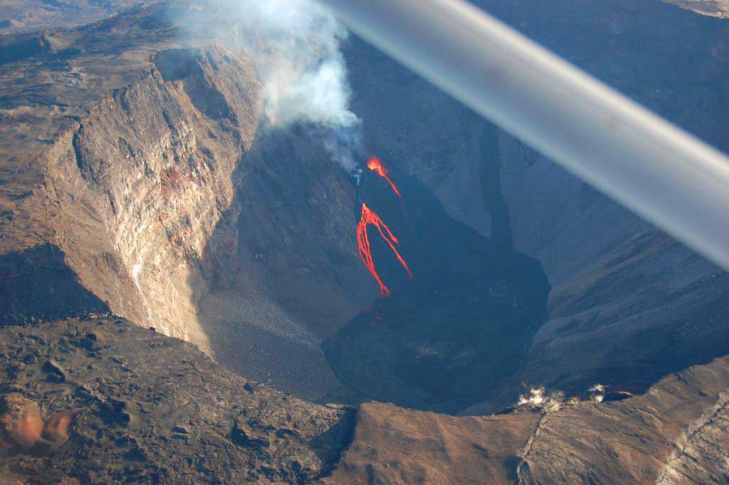
Since the spectacular eruption in April 2007, it has been impossible to walk around the craters. The summit landscape of the Dolomieu crater has been profoundly transformed: the floor of the crater has collapsed by around 300 to 360 metres following the partial emptying of the underlying magma reservoirs, creating a deep depression known as a pit-crater.
This geological upheaval has made the crater rims and walls extremely unstable, with cracks, frequent landslides and the risk of falling boulders even long after the event. For this reason, a complete tour of the summit craters remains strictly forbidden: current regulations only allow access to a single stable observation point on the eastern rim of the Dolomieu, when safety conditions permit.
Despite these very real dangers, some careless hikers sometimes stray off the marked paths, exposing themselves to falls, collapses or areas of fragile crust. In the event of infringement of the prefectoral decrees regulating access, fines may be levied by the forces of law and order, as public safety is a priority on this volcanically active site.
As the weather changes very quickly in this area, it's best to start climbing early in the morning (around 7am). The area around the volcano becomes dull fairly quickly in the late morning, so it's best to get to the summit as early as possible to enjoy the view and return in good conditions. The information point will allow you to confirm your intentions in complete safety. www.fournaise.info
And to walk on the lava (the gratons), you need good shoes, as trainers are out of use in 2 or 3 hours.
Guided tours
To discover the volcano in depth and get off the Enclos trails, it's best to enlist the services of an experienced guide. We recommend mountain guide Patrick Leu, who holds a Diplôme d'Etat d'Alpinisme. He'll show you how this volcanic massif works in detail, its eruptive mechanisms, its mineral and botanical world, its geological history and the history of its eruptions.
Mail: allonbatapat@orange.fr
Tel: +262692879516
www.allonbatapat-rando.re
Text : Brigitte Postel
Photos : according to Indication